We build websites, online stores, CRMs, chatbots and custom maps with you, start to finish.
You work with the person who builds it, from the first call to launch.
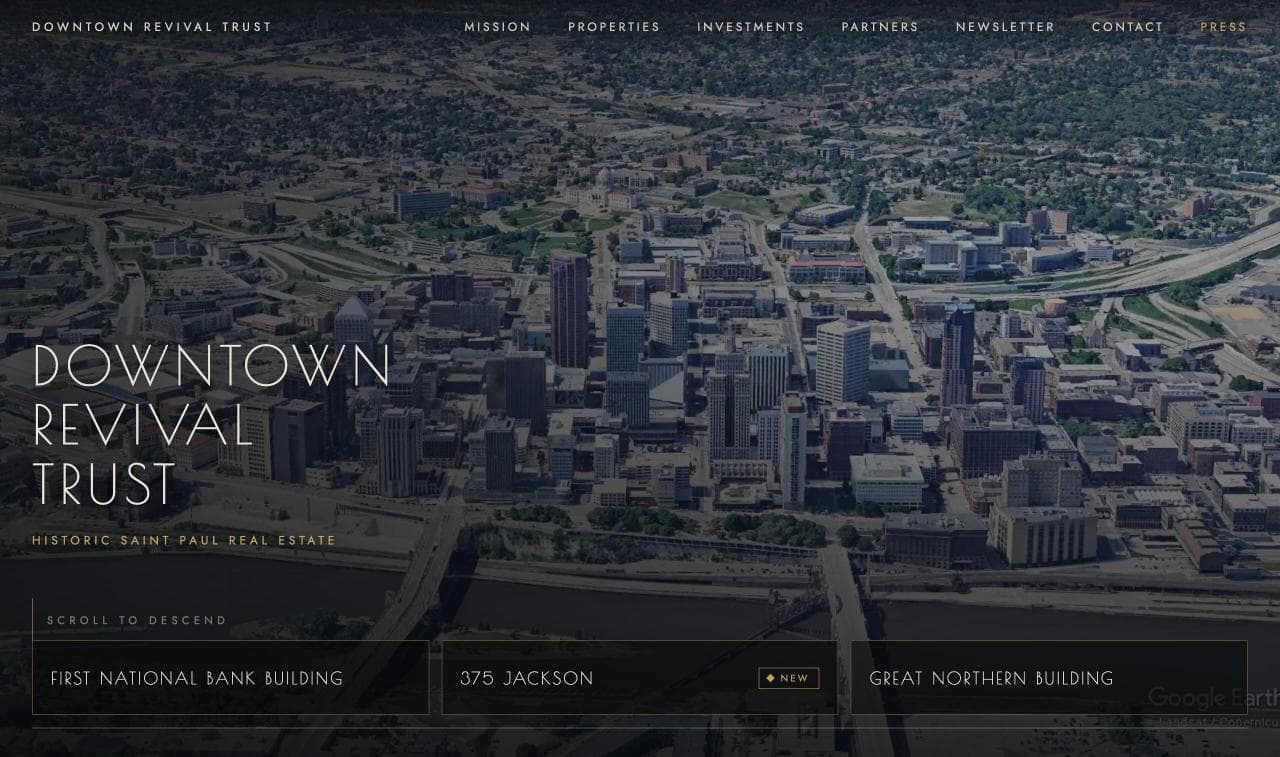
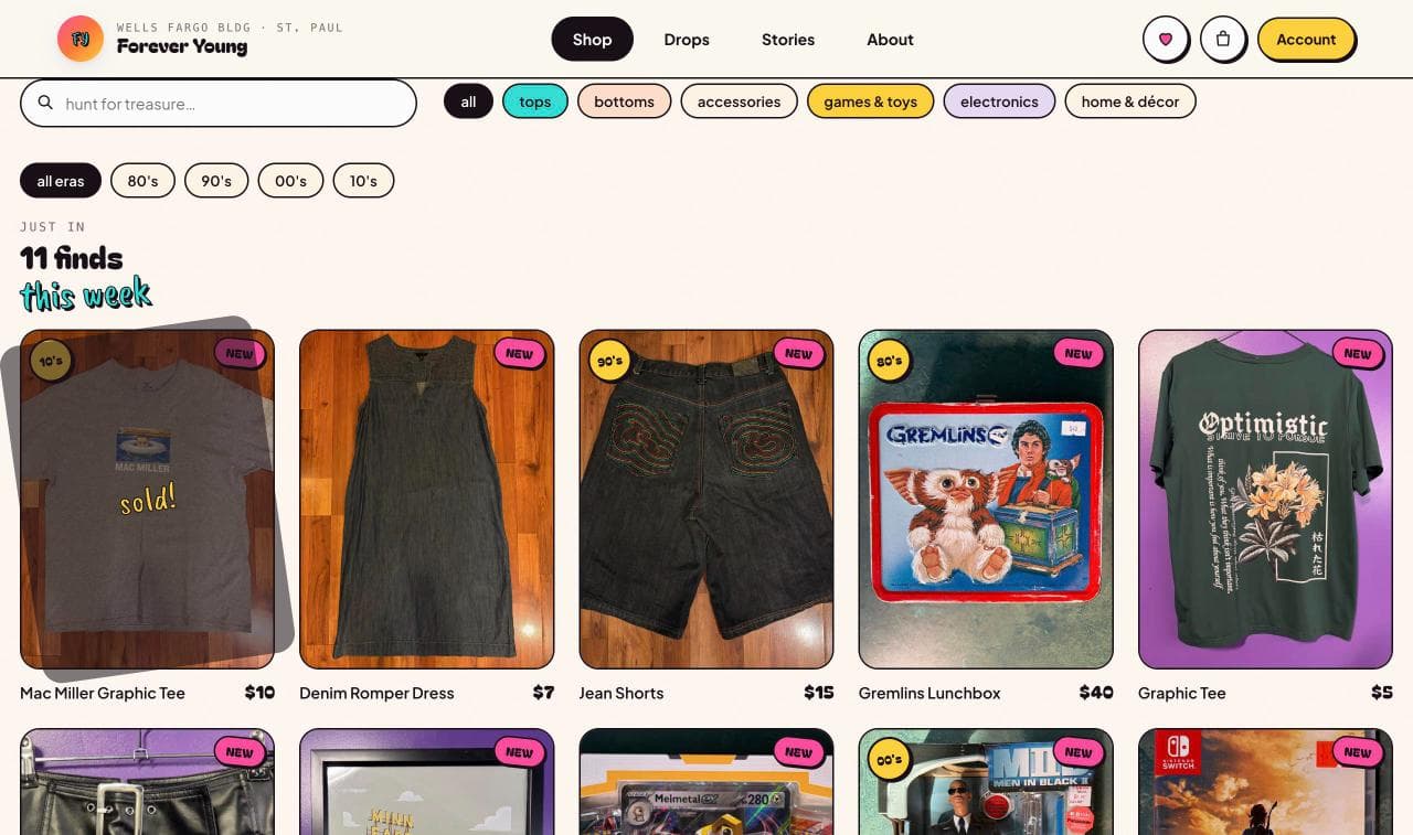
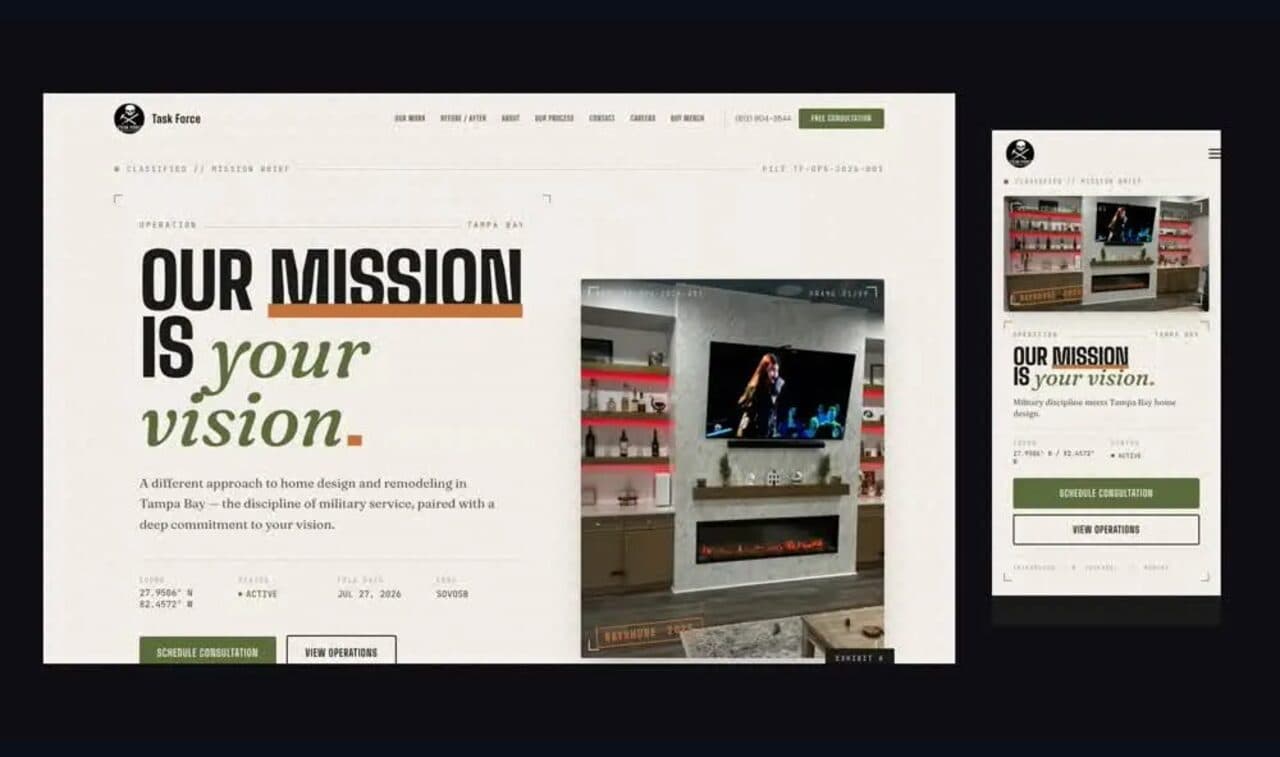
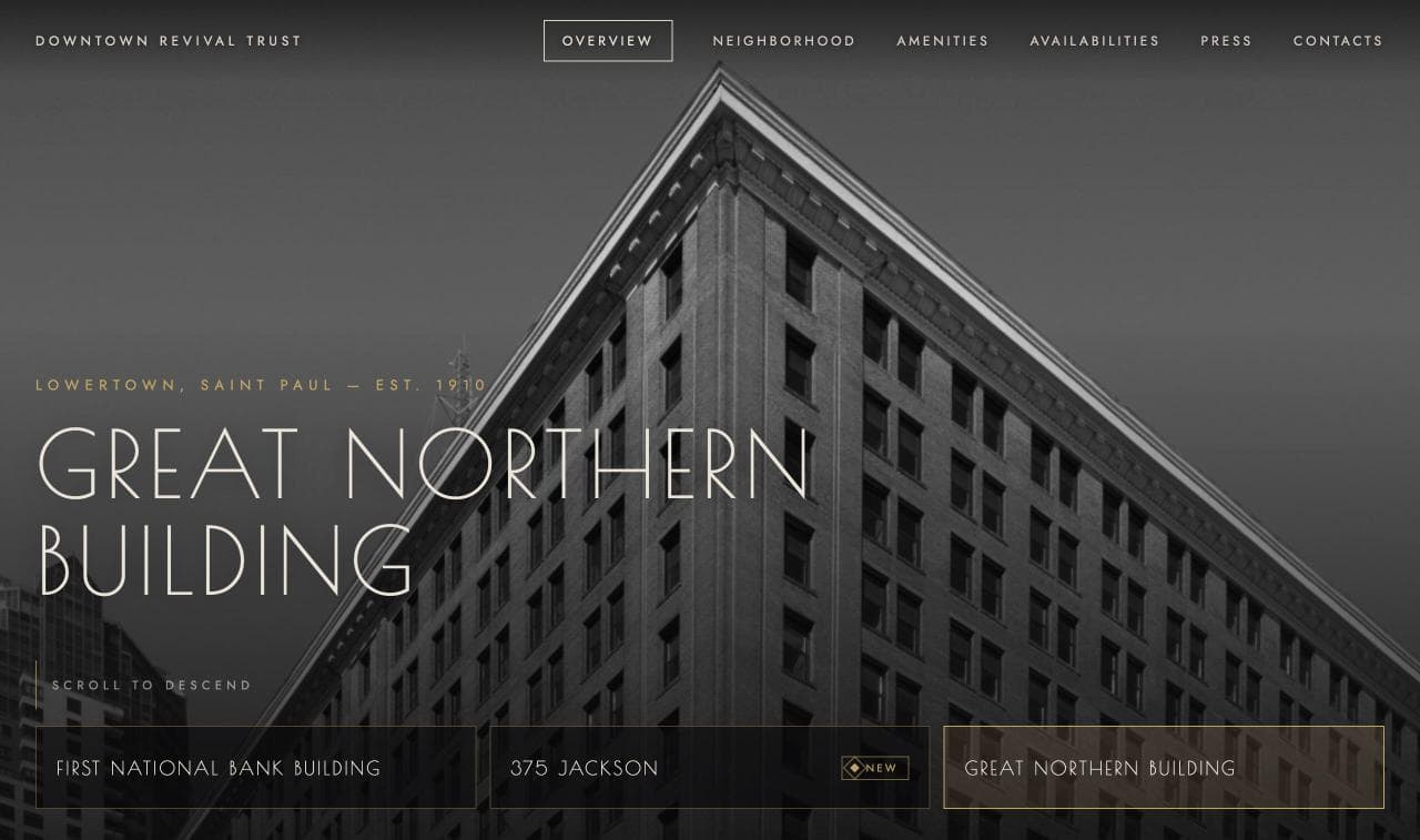
Downtown Revival TrustGreat NorthernForever Young ThriftTask Force BuildsDazzling Doggie Duvet4,500+ people used the skyway map we built, in the three months to September 2026.
What we build
Eleven things we build, one person to build them.
A site that says what you do and gets people to act, built new or rebuilt from the one you have.
New sites · Redesigns and rebuilds · Moves off site builders · Structure and words that convert
Great NorthernRebuilt from an aging site builder
An online store built around how you actually sell, one product or ten thousand.
Catalogues of any size · Made-to-order builders · One-of-a-kind stock · Synced with your register
Forever Young ThriftOne-of-a-kind stock, listed from a phone
A website for your building: available suites, a scroll that plays like a film, space-available emails.
Available suites · Space-available emails · A film-like scroll
Downtown Revival TrustFour sites: the Trust's own and three of its buildings
Your leads, clients and follow-ups in one place, built around how you work.
Lead pipeline · Client records · Email campaigns · Hiring and applications · Members and events
Task Force BuildsLeads, clients, campaigns and hiring in one admin
An assistant that answers from your facts, not guesses, and hands off to you when it should.
Website assistants · Voice shopping assistants · Answers from your documents · Hand-off to a person
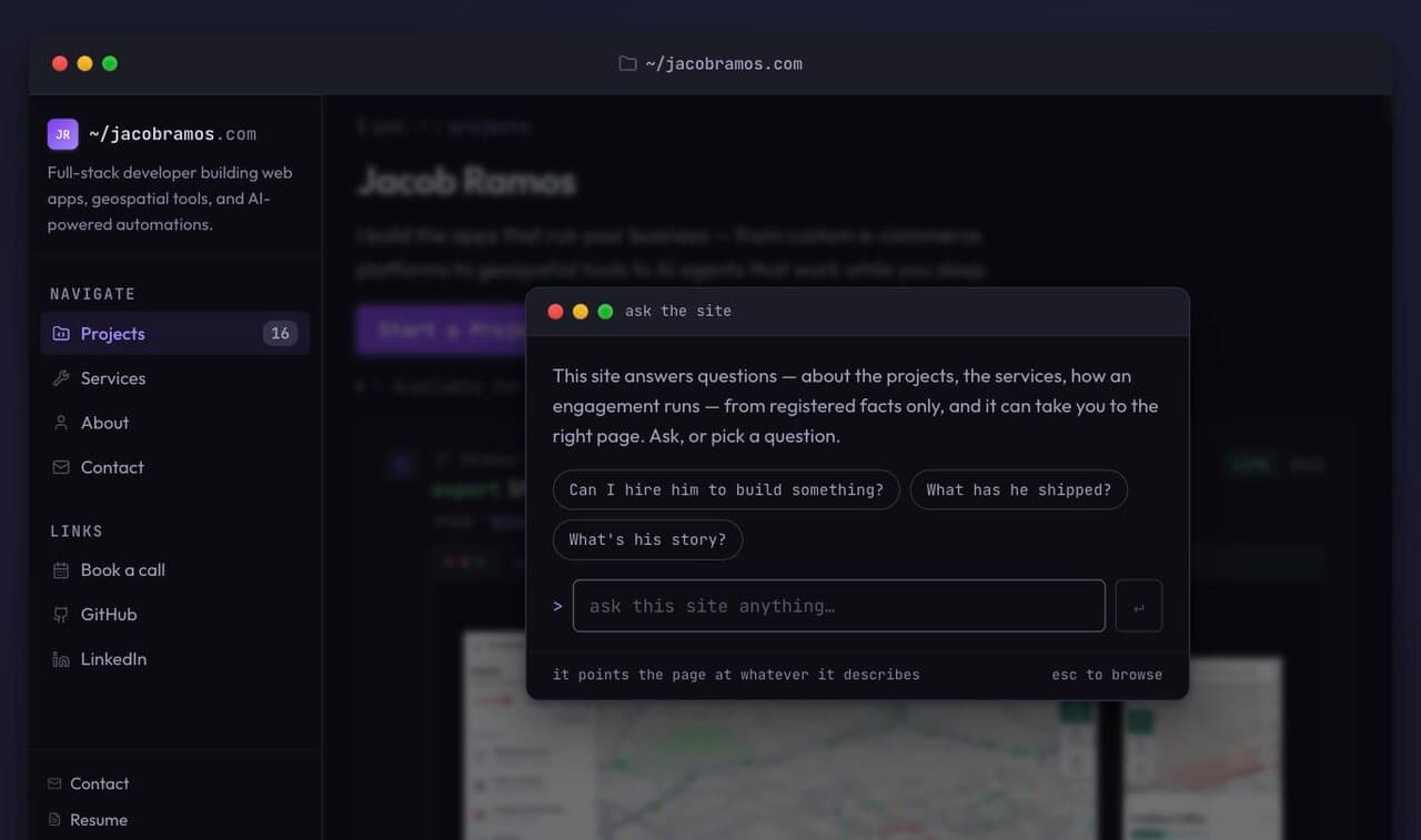
jacobramos.comAn assistant that answers only from verified facts
The emails and hand-offs that should happen on their own, and now do.
Order and pickup emails · Follow-ups and newsletters · Scheduled broadcasts · Your tools, talking to each other
Forever Young ThriftPickup emails the moment an order is ready
Let people book, pay and sign up without a phone call.
Online booking · Paid sessions · Store checkouts · Subscriptions
jacobramos.comBooking with paid sessions
An interactive map of your place (buildings, routes, directions) that people actually use.
Routes through buildings and skyways · A directory on the map · Accessible directions · Live data
The skyway map60+ buildings on one live map
Sign-ups, check-ins and head counts for events that fill a room.
Registration with guests · QR check-in · Capacity and waitlists · Ratings and surveys
The $5 dinner155 attendees and 511 check-ins in one night
A downtown's website, map, directory and events as one system, with numbers your board can check.
Directions on visitors' phones · A directory owners keep current · Events · Usage numbers for funders
$16.6K+Estimated downtown spending in one night, from one dinner
Launch is the start. If you want, we stay on: updates, fixes and new features as you grow.
Updates and fixes · New pages and features · Speed and search checks · A direct line to the builder
The plans
An affordable starting point.
Professional design and functionality at unbeatable prices.
- Care$99 a monthYour website, hosted and kept up for you
- Front Door$397 a monthPlus every lead texted back in 60 seconds
- Front Door + AI$697 a monthPlus a receptionist that answers your calls
A standard site, up to about five pages or sections, is included with any plan. Online stores and more custom builds cost more, and you may pay for the build.
Templates to start from
- Restaurant and takeoutRestaurants and cafes
- Hair salonSalons, spas and studios
- Pressure washingTrades and home services
- Photo booth rentalPhoto booths and events
- Clothing boutiqueShops
- Injury law firmOffices and professionals
- Bagel cafeRestaurants and cafes
- Med spaSalons, spas and studios
- Lawn and landscapingTrades and home services
- Kids party rentalsPhoto booths and events
- Vintage shopShops
- Dental officeOffices and professionals
- Custom cake shopRestaurants and cafes
- Tattoo studioSalons, spas and studios
- Home electricianTrades and home services
- Event rentalsPhoto booths and events
- Gift and art shopShops
- Therapy practiceOffices and professionals
- Deli and cateringRestaurants and cafes
- Tailor shopSalons, spas and studios
- Furnace and AC repairTrades and home services
- Tent and table rentalsPhoto booths and events
- Cash home buyerOffices and professionals
- Wine barRestaurants and cafes
- Dog grooming studioSalons, spas and studios
- Residential plumberTrades and home services
- Veterinary clinicOffices and professionals
- Dog daycareSalons, spas and studios
- Fence companyTrades and home services
- Flooring and stairsTrades and home services
- Cleaning companyTrades and home services
- Auto repair shopTrades and home services
- Auto body shopTrades and home services
- Collision and towingTrades and home services
- House paintingTrades and home services
The work
Real sites, live today.

Who you'll work with
You'll work with Jacob Ramos.
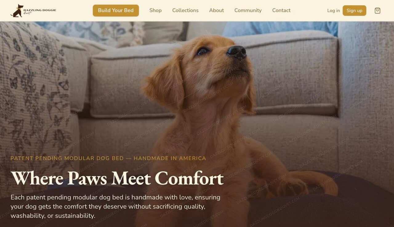
Jacob built the Downtown Revival Trust's four sites, spskyway.com (a live map of the Saint Paul skyway), Task Force Builds' site and CRM, and the stores for Forever Young Thrift and Dazzling Doggie Duvet. He works from downtown Saint Paul.
- You talk to the person who builds and runs it, not an account manager.
- Your customer lists and inquiries are yours, and you can export them anytime.
- 60+buildings on the skyway map
- 4,500+people used its wayfinding, three months to September 2026
- $16.6K+estimated spending downtown in one night, from one dinner
What happens on the call.Thirty minutes. You tell Jacob what you're building and what isn't working. He tells you what he'd build, what it would do for you, and what he'd need from you to start.
How it connects
It starts with being found.
People look a shop up, like what they see, and walk through the door. Everything the shop shares online, its hours, products and events, helps the next customer find it too.
How it connects
Busy storefronts lease buildings.
A lively ground floor is the first thing a prospective tenant sees. And the people who work upstairs become the shops' regulars.
How it connects
Every lease and every sale adds up.
Together they show what's working downtown. The district shares that proof with funders and investors, and sends more people back to every door.
Proof
It’s measured.
The people on this map are people downtown: who came, where they went, and what a night was worth. The figures beside the restaurants come from one dinner in Lowertown; the wayfinding count is real use, with its dates.
Questions
Before you ask.
Do you work with businesses outside Saint Paul?
Yes. Most first calls are on Google Meet and the work happens online, so you can be anywhere. If you're in Saint Paul, we can meet in person.
Who will I actually work with?
Jacob, from the first call to launch, and after if you want. No account managers.
What's mine to keep?
Your domain, your customer lists and your inquiries. You can export them anytime. The site itself is built and run on our platform, and if you'd rather own it outright, Jacob can walk you through that.
Can you work with what I already have?
Yes. We can rebuild a site you've outgrown, move a store off its platform, or connect the tools you already use.
What happens on the first call?
Thirty minutes. You tell Jacob what you're building and what isn't working. He tells you what he'd build, what it would do for you, and what he'd need from you to start.
Do you stay on after launch?
If you want. Launch is the start: updates, fixes and new features as you grow.
Where next
Eighteen places, one map. Pick one.
Get started today with a 30-minute consultation.
Book a timeCall or text (651) 378-1161